Where Was the 0 Milestone?(See page 44 of Khirbet Nisya: The Search for Biblical Ai 1979-2002 for actual measurements.) Early in our research on this problem, we came to the perplexing conclusion that the twelfth mile marker was out in an open area beyond el-Bireh. That was because we measured the distance from the Damascus Gate. Later, studies by Vincent (1901) and Clermont-Ganneau (1888) convinced us that with the 0 milepost somewhere well inside Jerusalem, distance and milestone discrepancies could be reconciled. The 12th stone had to be very close to el-Bireh.
The Medeba Map (Fig. 4, Locating Bethel, Part I), quite stylized like other ancient maps, is not of much value in locating Bethel. It demonstrates that Bethel existed somewhere north of Jerusalem. But that fact is plain from other sources. To locate Bethel using the Medeba Map with the exactness this problem requires stretches the evidence. We wonder what Avi-Yonahs proof is that the column on the Medeba Map was the milliarium aureum of Jerusalem? The column was more likely commemorative, similar to Trajans column in his forum (See Fig. 3, in Locating Bethel, Part I). This fact would add to the distance measured from the Damascus Gate and allow for the fraction of a mile difference needed to put Eusebius-Jeromes twelfth milestone exactly in modern el-Bireh. We already saw (end of Locating Bethel, Part I) that the twelfth milestone should have been in el-Bireh. Now we find that the correct distance also goes there. Albright is not correct when he says, Beitin lies opposite a point some eleven Roman miles north of Jerusalem (Kelso 1968: 3). By any consideration, Beitin is considerably more than 11 Roman miles from Jerusalem. The point is, whether you measure by distance or milestones, neither measurement brings you to Beitin. We feel justified in concluding that the last evidence remaining for identifying Beitin with Bethel (that of Eusebius/Jerome), actually identifies Bethel with another site.
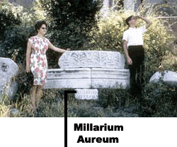
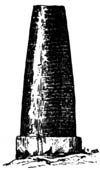
If the third milestone was at Safat, then we should consider again Vincents and Clermont-Ganneaus investigations (Vincent 1901, Germer-Durand 1887). Both had actually viewed the third stone at Safat, and both independently measured the distance back toward Jerusalem. Both also concluded that the milliarium aureum could not possibly be at the Damascus Gate. Thus, it is unlikely that the column represented on the Medeba Map (Fig. 4, Locating Bethel, Part I) was the 0 milepost. The only factual way to determine this would be to find the base of the column. What seems to be the base of the 0 milepost in Rome is still in place and underneath is a large stone clearly inscribed milliarium aureum. (See Fig. 8) Visitors can see it to this day. The author is not aware that the milestone column itself has been discovered in Rome. But it is reasonable that it would have approximately the same shape as the milestones themselves, although larger. Roadside milestones in Palestine were about 150 cm. high (beginning above the square base), and the upper portion cylindrical in shape. The Damascus Gate column of the Medeba Map is not that shape. In fact, it seems to have a capital on top. Furthermore, we should keep in mind that the central milestone in Rome is in the temple area of the main forum. Would we not expect it to be placed also in the temple area of Jerusalem, about a half mile or so south of the Damascus Gate? Until visible evidence regarding the Damascus Gate column is available, we do better to base our investigations on milestones and measurable distances available to us. Rama: Between Sixth and Seventh MilestonesAt Rama the 6th and 7th milestones straddled the city (Livingston 1971: 49). One turned off at the 6th when coming up from Jerusalem, and at the 7th when approaching from Bethel. In 1969, the author measured the distance from el-Birehs center with a Mercedes odometer. The distance to a point opposite er-Ram (Ramah) was 7.7 km (4.4 miles, 4.9 Roman miles). (To the Latrun road was 7.7 km (4.8 miles, 5.4 Roman miles). Total distance to the Damascus Gate was 16.2 km (10.1 statute miles, 11.2 Roman miles). Add 1/2 mile to put the 0 milepost inside Jerusalem, where it no doubt was. This gives 6 statute miles, which corresponds to about 6 1/2 Roman miles, exactly the right distance (between the 6th and 7th markers). The remaining distance to el-Bireh, about 4 1/2-5 statute miles (5-5 1/2 Roman miles), means the 12th marker could not possibly have been far from it. We encourage interested scholars to check these facts for themselves. If the 12th marker (approaching from either direction) was near el-Bireh, should not el-Bireh at least be considered as the location for Bethel, instead of Beitin? The fifth milestone on the road northward from Jerusalem has been found and had clearly inscribed numbers in both Latin and Greek (Clermont-Ganneau: 1888: 280-284). Its location allows one more, the sixth, to have been located at the road turning into Rama (er-Ram) off the main northward route. The seventh, then, would have been where the road north out of the village joined the main road. Based on the fact that the fifth marker was found at least one mile southwest of er-Ram, one would expect eventually to find a sixth near er-Ram to the south. Thus from this point of view, also, it appears that in the Byzantine period Bethel was located at el-Bireh, and not at Beitin.
Eusebius-Jeromes statements concerning 12 miles, if only as a measurement of distance from the Damascus Gate of Jerusalem, would bring one to an indefinite place somewhere between Bireh and Beitin. However, even if Roman roads were straighter than the present one, twelve Roman miles still would not take one to Beitin. The Roman road apparently went through er-Ram (and the distance would approximate the modern road with the Jerusalems Atarot Airport by-pass). If the Roman road was longer than the present one built with modern machinery, its greater distance may have required the placing of the twelfth marker in el-Bireh. Khirbet esh-She: Milemarker 10 or 11?
Michael Avi-Yonah, in his Map of Roman Palestine (1940, 44), listed a milestone at Khirbet esh-She, about a mile south of el-Bireh. If, as he said, it is the tenth, then the eleventh was in el-Bireh, which in turn puts the twelfth between el-Bireh and Beitin. However if the stone at esh-She is really the eleventh milestone, as the location of the earlier milestones requires, then the twelfth milestone was at el-Bireh. Even if the esh-She stone (which is no longer available and was never published) did turn out to have only an X and/or i (Greek l0), making it seem that 10 miles is correct, it would only be necessary for there to have been one more letter to the right, an I and/or alpha, to make it the llth milestone. It would be necessary to determine whether this extra letter was worn or chipped off. Milepost 15 Is Near JifnaMilepost 267 (in the catalogue of P. Thomsen) reads IF in Greek, or thirteenth mile, and was found near Jifna (Thomsen 1917: 76). However, in a study of the eighteenth milepost at Yabroud (Milestone 260) C. Clermont-Ganneau pointed out that Jifna (ancient Gophna) was listed in the Onomasticon as being at the fifteenth or sixteenth milestone (1907: 93-94; cf. Eusebius 1904: 168). We suggest, on this basis, that the reading should be IE (15) instead of IF (13). This accords with Eusebius distance for Jifna and agrees much better with other road distances. Significantly, it further confirms el-Birehs location at the twelfth marker. La Grande Mahomerie Was in Bethel
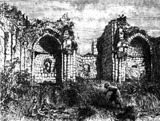
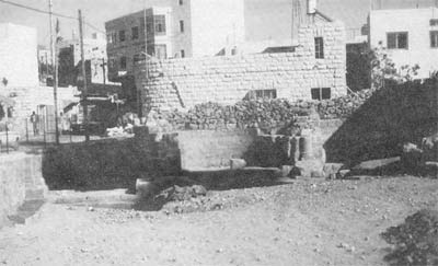
In the early centuries of the Church some European Christians who made pilgrimages to the Holy Land wrote journals about their travels, several of which were published. Since the locations of many biblical sites were still known, their reports can be helpful in finding correct locations, and they often confirm identifications made by Eusebius and Jerome. An important consideration from one of these reports follows. What was La Grande Mahomerie? The best explanation of its meaning was given by F. M. Abel (1926 274: 75). He indicates that the Crusaders named their church that name because a Muslim sanctuary was revered in that place. Afterward it fell into disuse and was forgotten. The remains of a recently excavated Crusader church can be seen today in el-Bireh. Next to it on the south is an ancient Muslim holy place, a weli (or grave), built over an earlier church. W. M. Thomsen noted: It is part of the tradition that the ruined church was erected here by the Knights Templars to commemorate that event in the life of Jesus (when his parents returned to Jerusalem to look for him), since el-Bireh is the limit of the first days journey of pilgrim caravans northward from Jerusalem ... (1882: 87). How can the location of La Grande Mahomerie help locate ancient Bethel? One problem is that scholars seem unable to let go of the generally accepted location of Bethel at Beitin. The following is an example of what this error causes: Bethel, ancient Luz, where Jacob built his altar, was identified by most Christian travelers of the Crusader period with Kh. Luza on Mount Gerizim. In this way they followed the Samaritan tradition. Only a few identified it correctly with the village of Beitin, northeast of Ramallah (and el-Bireh). One of them, an anonymous traveler, wrote: "Mahomerie was first called Luza and afterwards Bethel . . . identifying Bethel with Mahomeria or al-Bira, two kilometres (actually 3 km.) from Beitin. Burchard of Mount Zion in grand style locates it near Nablus and further on near Ramallah (Benvenisti 1970, 3 18, our emphasis). Note that Benvenisti equated Bethel with Beitin -- the traditional identification. Then he quoted a pilgrim and Burchard who both contradict him! The first traveler quoted above equates Mahomeria with Bethel. Benvenisti himself correctly understands the pilgrim to say that Bethel was at Mahomeria or al-Bira, but he then makes a leap of logic and places Bethel at Beitin, apparently because that is the opinion of most! Finally he notes that a location for Bethel suggested by the second pilgrim -- the thirteenth-century German monk Burchard -- is near Ramallah (which adjoins el-Bireh). Obviously, early pilgrims understood Bethel to be at el-Bireh.
The text referred to is the following:
el-Bireh is not BeerothOne mile discrepancy between Eusebius and Jeromes account, did not hinder Robinson from attempting to identify el-Bireh as Beeroth (followed by Ritter and many others). But they all made a major misinterpretation of Eusebius by saying: . . . according to Eusebius, Beeroth was seen by the traveler in passing from Jerusalem to Nicopolis (Imwus), at the seventh Roman mile. This road was the present camel-path from Jerusalem to Ramleh passing near el-Jib (biblical Gibeon). . . The traveler on emerging from the hills into the plains around el-Jib sees el-Bireh (Beeroth) on his right after a little more than two hours from Jerusalem (Robinson 1856: 452).
One of Robinsons few errors was in equating biblical Beeroth with el-Bireh (1856.I: 452: cf. his map. See also Livingston 1970: 39-41). Robinsons selection of el-Bireh as Beeroth, however, clashes with Eusebiuss statement in the Onomasticon, which indicates that Beeroth is seven miles distant from Jerusalem (Eusebius 1904: 48). The only way Robinson could see el-Bireh from the point of which he speaks is at a distance of about three or four miles, for that is the distance from el-Jib to el-Bireh. It is possible to see el-Bireh from there since it is so prominent, but that is not what Eusebius meant. He plainly said Beeroth is at the seventh milemarker on the road to Nicopolis,, not on the road to Neapolis (modern Nablus). The distance Eusebius gives puts Beeroth somewhere between modern Biddu and Nebi Samwil. Thus the road to Beeroth went mostly westward from Jerusalem, not northward. Rupert Chapman pointed out in correspondence (to John Bimson, 8 March 1988) that the Onomasticon locates Gibeon four miles from Bethel (Eusebius 1904: 66-67). He wrote: There is a track shown on the Palestine Exploration Fund map which leads to el-Bireh via Rafat. This is important because Robinson had said one could see Beeroth from Gibeon since he equated Beeroth with el-Bireh. But, as Chapman reminds us, the Onomasticon is NOT talking about Beeroth. S. Yeivin also makes it clear that el-Bireh cannot be ancient Beeroth: As to Beeroth, there is a large divergence of opinion among scholars . . . Abel identified it with el-Bireh . . . (this suggestion has been adopted by many scholars). The identification, however, clashes with Eusebius statement in the Onomasticon that Beeroth is seven miles distant from Jerusalem (Yeivin 1971: 141). As he suggests, el-Bireh cannot possibly be ancient Beeroth based on Eusebius identification, in spite of what some scholars assume. It must be some other ancient city. El-Bireh is 10.3 statute miles (1l-12 Roman miles) north of the Damascus Gate, while Eusebius-Jerome say Beeroth is only six - seven Roman miles out of Jerusalem. This leaves el-Bireh unidentified. Do Eusebius-Jerome give any identification for el-Bireh other than Beeroth (which we have seen is impossible)? Yes. What is it? BETHEL. Bethel Is Beneath el-BirehEl-Bireh is precisely on the natural east-west geological dividing line, or border. The topography of the area around Ras et-Tahuneh (the highest point in Ramallah/el-Bireh) is such that it has a horizontal hour -- glass effect. That is, there is a plain on the north and another on the south. On the other hand, deep valleys run to the east and west, forcing travelers to pass close by this high point. During the Crusades, el-Bireh, controlled by the Knights Templar, was called La Grande Mahomerie and was obviously an important fortress and a place of pilgrimage. It seems significant that the Crusaders chose this spot to defend rather than Beitin. It is the place on the Jerusalem-Nablus road to effect a roadblock. The Israelis made good use of this fact in the Six-Day War when they captured this spot early in the fighting. Jeroboam may also have put his temple at Bethel right there! When placing Bethel on the road north out of Jerusalem, it is on the right side of the road going to Neapolis (Eusebius of "Bethel). But, even more important, it is the correct number of Roman miles out of Jerusalem. Finally, Beth-Aven, wherever it is, would now be west of Michmash and not north of it (as it is in the case of et-Tell). The High Place at Bethel?Surface surveys at Ras et-Tahuneh have shown evidence of occupation as early as the Chalcolithic, Early Bronze, and Middle Bronze periods (as well as several later periods including Iron Age (Kochavi 1972: 178). However, Bethel is not likely to be found there, since Raset-Tahuneh lies on the left (west) side of the road as one travels north to Nablus. Bethel, on the other hand, is described as being on the east side of the road. Ras et-Tahuneh is also too small to be the site of a town as important as Bethel, but may have been the "high place" for the city.
Bethel should be somewhere between the now excavated Crusader church and the spring at the south end of the town (covered by a small mosque), on the right-hand side of the road as one travels north through el-Bireh. Pilgrim Evidence: A Potential Identification for BeitinIn the The Pilgrim of Bordeaux (Wilkinson 198l: 155), the pilgrim says, Twenty-eight miles from there (Nablus) on the left (east side) of the road to Jerusalem is the village called Bethar (f.n. Bethaun or Bethaven, Joshua 7:2, l8:l2), and a mile from there is the place where Jacob slept on his way from Mesopotamia (f.n. Bethel) . . . Jerusalem is twelve miles further on. A 19th-century traveler, John Wilson, seems to have overlooked or misinterpreted this reference when he said, The Bordeaux pilgrim, AD 333, places it (Bethel) at twenty-eight miles from Neapolis, on the left of the road to Jerusalem, giving it the name of Bethar. . . (Wilson 1847: 288). The pilgrim plainly said that Bethel is a mile south of Bethar. The point is, there is a little village named Bethar by this pilgrim north of Bethel. If el-Bireh is Bethel (at the twelfth Roman milestone north of Jerusalem), the next village north on the road to Nablus is modern Beitin. It should be clear at this point that the village there was known as Bethar (and possibly Bethaun or Bethaven) by this pilgrim in about AD 333, at almost exactly the same time as Eusebiuss Onomasticon was written. In the Onomasticon itself the authors even spell Bethaven as Bethaun (Eusebius 1904: 50-51). As far as this pilgrims account is concerned, the problem with postulating that modern Beitin was Bethel is that there is no village or ruins along the road north of Beitin itself to equate with Bethar. On the other hand, excavations at Beitin have shown occupation for the times Bethaven is referred to in the Bible. Linguistically speaking, the modern name Beitin may have derived from Bethaven. Among others, C. R. Conder suggested that Beitin could be either Bethaven, Bethel or just Aven (1879: 334-35). Besides Bethaven, two other possibilities to consider for Beitins identification are Ophrah (Joshua 18:23, 1 Samuel 13-17) and Zemaraim (Joshua 18:22, 2 Ch. 13-4). Y. Aharoni mentions that Zemaraim must be in the vicinity of Ramallah and el-Bireh on the Judaean border (1966,287). Beitin fits this identification very well. Most scholars place Ophrah at et-Taiyibeh (Aharoni 1966: 1; Baly 1974: 175). However, this may be because Bethel itself has been misplaced. Y. Kaufmann wrote that Ophrah may not be at et-Taiyaibeh at all since it is in the lists of both Benjamin and Ephraim (1953: 13-14). Thus Beitin itself can be considered a candidate for Ophrah. ConclusionIn light of the distance measured by Roman milestones, the traditional, biblical, topographical, etymological, geographical, and archaeological reasons given above, the burden of proof lies on those who continue to hold that Beitin=Bethel. FinallyWe are not trying to prove the Bible. It does not need proof. It claims to have been inspired by God (II Samuel 23:2-3, Isaiah 59:21, Jereremiah 1:9, II Timothy 3:16, II Peter 1:21) though penned by men. One either believes that or he does not. We have based our case on the assumption that it is truth. |