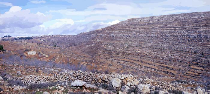
IntroductionFor more than 150 years scholars have agreed that the village of Beitin, north of Jerusalem, is the site of biblical Bethel. W. F. Albright and James L. Kelso led excavations there intermittently, beginning in 1934. Thus, it has become almost unanimously accepted that Beitin is Bethel. The final publication was The Excavation of Bethel in 1968. While Ai and Bethel were twin cities, our chief interest has been to find Ai. To do this it was necessary first to review the reasons for locating Bethel at Beitin. This important biblical city is mentioned more often in Scripture than any other city except Jerusalem. Its proper location is essential. Albright said, [Bethel] is regarded by all topographers of competence as one of the cornerstones of ancient Palestinian topography (Albright 1968:3). Bethel was so strategically located on the border between Israel and Judah that it was there Jeroboam built his southern temple to the golden calf (I Kings 12: 25-33). He did this to intercept worshippers traveling to the Temple in Jerusalem. Bethel is also the geographical key to locating other cities in Benjamin and Ephraim. Jacob dreamed of (temple) steps going into heaven while at Bethel. It may be no coincidence that step-like ledges appear on the west slope of Jebel et-Tawil (Fig. 3.1). If one assumes Beitin is Bethel, proofs given may seem convincing. However, these proofs leave many unanswered questions. For instance:
Therefore, we propose that Bethel is at el-Bireh, and not at Beitin. The Original Identification of Bethel at BeitinThe evidences advanced for the identification Beitin = Bethel cover five areas: 1. tradition, 2. archaeology, 3. Bible, 4. etymology or toponymy, and 5. patristic testimony. The last two, etymology and patristic testimony, were utilized by Edward Robinson to locate Bethel in the nineteenth century. (Actually, tradition can also be included, inasmuch as the tradition identifying Beitin with Bethel was declared for the first time by Robinson.) That his conclusions have been generally accepted is evident in what Albright said: But no scholar made the obvious identification of Beitil with Khirbet Beitin, an hours walk northeast of el-Bireh, until it fell into the lap of the great American Biblical topographer, Edward Robinson, along with many other sound identifications, in May, 1838. He examined the extensive ruins of the ancient city, then entirely unoccupied, and noted that the phonetic relation of Beitin to Beitil is normal in Arabic. Since the publication of Robinsons results in 1841 no competent topographer has hesitated for a moment to accept the identification as essentially correct . . . .(Albright 1968:1, our emphasis). It is clear from this quotation that Robinson made the initial convincing identification. Others have followed his lead. What were the proofs used for the identification? He wrote:
Traditional Site of Bethel Questioned*(*We urge the reader to examine the correspondence between James Kelso, W. F. Albright and the author in Khirbet Nisya: The Search for Biblical Ai 1979-2002, Appendix II.) The problem is whether ones research is inductive or deductive. If the former, we do not know of any single fact which clearly and independently demonstrates that Beitin is Bethel. All is questionable and capable of double interpretation. If one argues deductively, that is, assuming that Beitin is Bethel, then a number of items may be construed as evidence for Beitin, if there were no other possible site in the area.
Biblical Evidence for Beitin=BethelA problem in identifying the site on the basis of biblical material is that specific references to direction and distances of neighboring towns are almost nonexistent, even though the Bible mentions Bethel often. There is no study identifying the site biblically in The Excavation of Bethel. The reader is referred to Sternbergs comprehensive biblical study in 1915, which is no more helpful than The Excavation of Bethel, although there is a survey of the biblical references in chapter ten, assuming Beitin is Bethel. Biblical references conveying geographical and topographical inferences are few. The location of Bethel depends as much on Ai as vice-versa. (Bethel is west of Ai: Genesis 12:8; Joshua 7:2; 8:9,12.) It is beside Ai (Joshua 12:9). But if Ai has not been discovered after careful search over a large area, what does that say for the equation Beitin=Bethel? Albrights conclusion on the biblical evidence was, I dont think we can say very much about the identification of Bethel with Beitin from Biblical sources. The references to Bethel make its general location clear; it must have been very near Beitin but none of them gives a specific reference except in connection with neighboring towns on the border between Judah and Israel or near Ai or Beth-Aven, both of whose identifications rest on Bethel = Beitin (personal correspondence: 2/16/1968, Khirbet Nisya: The Search for Biblical Ai 1979-2002, page 259). TopographyIt appears that scholars, in this case, have not given adequate consideration to the importance of topographical features mentioned in Scripture. In describing the topography around Bethel and Ai, Bible writers provided so much detail that it is difficult to find similar topographical features at other places in the region. If one takes Scripture seriously, the topography at Beitin/et-Tell lacks some important features. First, there must be a mountain (Heb. har) between Bethel and Ai. Second, there must be a valley (Heb. gai) north of Ai. Third, there must be a hiding place for the ambush. Fourth, there must be a morad (a descent) which leads to Jericho and a shevarim (breakers or broken) where the men of Ai (in the first battle) cut down 36 Israelites! Edward Robinson described the situation for the first point, The phrase, Mount Bethel, can only refer to the elevated ground around the city of Bethel, especially on the east, north, and west; but there is no particular summit or hill. It occurs twice. (Joshua 16:1, I Samuel 13:2). Conclusions regarding tribal boundaries are of value only after evidence demonstrates Beitin is Bethel. If it is not Bethel, some Scripture passages must be reevaluated. One scholar pointed out, The natural topographical border would then lie between Bethel (Beitin) and Mizpah (Tell en-Nasbeh); to the north of the latter there rises a prominent ridge . . . perched on it are the twin cities of Ramallah and el-Bireh (Rainey 1970-71: 184). This describes our theory exactly. That is, Bethel (at el-Bireh) is on the natural border, where it should be: on Ephraims southern border (Joshua 16:3)and Benjamins northern border (Joshua 18:11-13). Placing Bethel inside one or the other territories means the border line no longer goes through Bethel. ToponymyToponymy, in this case, seems a tenuous means of identification. With no corroborating historical evidence available, we do well to hold identification of this site by toponymy loosely. The common, now traditional, identification of Beitin with Bethel is comparatively recent. Important to note is the long gap in the tradition identifying Bethel. We do not question that Beitin might have devolved from Bethel. However, Beitin has been known by that name scarcely 150 years. Carl Ritter, in 1866, was familiar with the situation when he said, Notwithstanding that the site of the once so renowned Bethel . . . on the primitive boundary of Ephraim and Benjamin . . . was completely unknown at the beginning of the present century [the 1800s], yet there is no doubt concerning the identity of Bethel with modern Beitin (Ritter 1866: 449). Why insist on toponymy for proof when there is no historical reference to the site for 1400 years, thus there is no tradition relative to the name at all? Another possibility is that Beitin may have moved. Albright has himself considered this possibility (1968:1). Carl Wolf also said, ". . . even within biblical times the settlement as well as the name could wander from the original location (1964:90). ArchaeologyThere is no independent evidence from archaeology that Beitin is Bethel. For the MB-LB period, Beitin could be Bethel. But it may also have been some other town in that period. Nor does the fact that MB-LB remains are found at Beitin preclude the possibility that they are also under el-Bireh. Albright plainly stated in a letter to this author (personal correspondence: 1/30/68) that there is no independent archaeological evidence for Beitin=Bethel. Arguments deduced from the assumption that Beitin=Bethel only lend themselves to circular reasoning. If there is no real evidence, let us be done with archaeology for proofs. Jeroboams temple is mentioned in Scripture (I Kings 12:29, II Kings 17:16; 19:29) as being at Bethel, and it has not yet been found. James Kelso described what had been typical of the search: A major purpose of this campaign as of all earlier ones, was to locate Jeroboams temple, but, again, no clues to it were discovered . . . (Kelso 1968:4). Since some scholars have suggested that the temple was outside the city, several of our staff and workmen looked carefully for Iron II sherds at Burj Beitin ... but none was found (Kelso 1968: 8, Albright 1934:3). Find Ai, or Jeroboams temple, or other solid archaeological evidence, then the identification will be clear. But, with the most obvious and easily discoverable evidence still lacking, is it really far-fetched to question the identification of Bethel with Beitin? There are ruins of a church in Beitin. Conder and Kitchener describe it as of Crusader date, once dedicated to St. Joseph (Survey of Western Palestine [SWP]1883: 305). Thus it could not be a church commemorating Jacobs dream. There is doubt concerning the building at Burj Beitin, southeast of Beitin. The SWP says, The ruins of an ancient church at Burj Beitin may be those of the church mentioned by Jerome as built on the spot where Jacob slept (1883: 309). But, the ruins may also not be the church mentioned by Jerome. The reason the author confidently suggests this building was that particular church is seen in his preceding statement,The identity of Beitin with Bethel has never been questioned. Now that it is questioned, we do not hesitate to question the identity of this building. Actually, Burj Beitin is described by the SWP as a monastery subsequently converted into a fortress (1883: 307). That it has some Byzantine-type stones imbedded in its walls is evident. But that it was a church is not certain. Burj Beitin has never been excavated, according to James Kelso. Therefore, one should be cautious in making statements about Burj Beitin like that of the SWP, this spot . . . is probably a traditional site of Abrahams altar, east of Bethel (ibid., our emphasis). The reader will notice in our quotations above that in one place this building is said to be commemorative of Jacobs Dream, and in another place, of Abrahams Altar. It does not seem likely that the same building would commemorate both events, which only serves to amplify the uncertainty connected with this structure. Apparently there is no evidence that this building commemorates either event, other than that it happens to be near the place assumed to be Bethel. As we have pointed out, the archaeological evidence for Beitin=Bethel is elusive at every point. We do well to scrutinize the solid evidence available, while holding loosely to tradition and long-held opinions. How can we be certain this church mentioned by Jerome does not lie in ruins somewhere near el-Bireh? What Albright considered important archaeological evidence is a 1250 BC burn level at Beitin, supposedly confirming a conquest by Joshua. Albright said, Bethel fell into the hands of the Israelites, who burned it to the ground, somewhere in the thirteenth century . (1934:11 and 1939: 48). However, Scripture nowhere, not even in Judges 1, gives warrant for expecting an Israelite burn level at Bethel. Excavations at Beitin prove there was no Canaanite occupation during LB I (Kelso 1968: 58). William Dever gave his assessment of the situation, The site was destroyed with most others in the Egyptian reconquest of Palestine in the late 16th cent. B.C. and seems to have been unoccupied for most of LB I (Dever 1971: 463). Thus, at the biblical date for the Conquest (1400 BC) it was uninhabited (Kelso 1968: 28). Could this fact have contributed to Albrights change to a lower date for the Conquest? When the writer asked Albright for convincing archaeological proof for Beitin being Bethel, his reply was, I am afraid that the archaeological evidence for Beitin=Bethel would not necessarily be convincing without the Biblical and Patristic evidence. (Personal correspondence: 1/30/68, see Appendix II, Khirbet Nisya: The Search for Biblical Ai 1979-2002). From this we can come to but one conclusion -- there is no clear archaeological evidence that Beitin=Bethel. It is circular reasoning to say that the archaeological history agrees with the biblical history at Beitin. Assuming Beitin is Bethel (although there is admittedly no archaeological proof for it), and assuming the Conquest is late (in spite of I Kings 6:1, Judges 11:26, Acts 13:20), and assuming Joshua burned Bethel (although there is no biblical evidence for it), only then can archaeology be used as proof that Beitin is Bethel. Only then does the archaeological history bear out the biblical record. Are we justified in using archaeology to identify a site when that site cannot be identified by archaeology? In light of the uncertainty about Ai, the lack of evidence that et-Tell fits the biblical description, and the apparent reasons et-Tell is not Ai,we conclude that Ai has not yet been discovered. And since the location of Ai depends upon the location of Bethel, we ask the obvious question: Is Beitin really Bethel?
Summary of the Archaeological Evidence
Geographical Evidence for Bethel at el-BirehBethel was obviously at a road juncture and on the main trade route north and south. It was also at a junction for east and west traffic. Since all the north-south ridge roads come together like an hourglass at Ramallah/el-Bireh, it is the most obvious place to establish a roadblock to prevent seekers from the northern kingdom going down to the temple in Jerusalem. Jeroboam, first king of the northern kingdom, set up a golden calf (probably with a shrine) at the high place in Bethel. The excavations at Beitin by Albright and Kelso made every effort to find the high place there, to no avail. At a new site for Bethel (in el-Bireh) there is a prominent high place called Ras et-Tahuneh. Two surveys have been made there and both showed it in use during Iron Age II. In fact, the Benjamin Survey found that two-thirds of the sherds collected were Iron Age II, the period of Israels kingdom (Finkelstein & Magen 1993 English, 21*, Hebrew, pg 76-77; Kochavi 1972:178). Thus, we conclude that the true Bethel must have the characteristics of a living town. That is, because of its location, it almost never ceased to be inhabited; or if it did, then it quickly and naturally revived. In the hill country similar towns are Shechem, Bethel, Hebron (and Beersheba in the Negev), towns Abraham visited. There should be living towns in each of those places if we have properly identified the location of the ancient towns. (The other three towns are thriving, although Tel Beersheba, not likely Abrahams Beer Sheba is outside the modern city.) The question arises, why is Beitin a dead town today? There is a small community, but no market. It is not on any main road junction. It was not even occupied in Robinsons day when the first identification was proposed (Robinson 1856: 449). Bethel was a border town between Ephraim and Benjamin. What makes borders? Often geological formations. Baly points out that among other geological rifts going east and west across Palestine, one is a line drawn through Lydda (Lod), Ramallah and Amman (Baly 1957: 27) and another is . . . the valley of Aijalon leading up to Ramallah (ibid.: 28). This natural line of division is two miles south of Beitin. The author feels that the importance of this abnormal bulge northward in the border has been overlooked by geographers. The Bible says there was a mountain (Heb. har) between Bethel and Ai (Genesis 12:8). Yet Ritter says of Beitin, Abraham erected a tent in the valley between them [Bethel and Ai] (Ritter 1866: 223). (Actually, there is a small valley between Beitin and et-Tell.) Ritter then cites Genesis 12:8, which plainly says there is a mountain between the two! What is the propriety of changing Bible statements to fit actual conditions? It would seem better to point out that the topography does not agree with the biblical description. We conclude that Bethel should be both on the border, and a crossroads town situated on a natural geological division north and south (the ridge) and east and west (Aijalon and Suweinit Valleys). We should note that Beitin has been mentioned to be north of the pass (too far north to control it) and, although on an important east-west road, not at the main junction in the area. Finally, it is apparent that the topography of Beitin does not match the biblical description. Summary of the Geographical Evidence:
The Patristic Evidence:
|
|
|
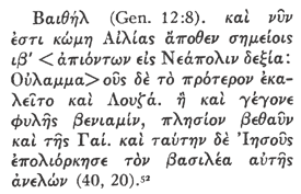
| Bethel (Genesis 12: 8). Now is a village 12 signs (milestones) on the right going up from Aelia toward Neapolis. Bethel was at first called Luz. Then it became (part of) the tribe of Benjamin with Bethaun and Aggai close by. And Joshua fought against it and showed no mercy to the king. | Bethel the village at the 12th milestone from Aelia on the right side going to Neapolis which was first called Luza, having been called this it was then cast as a lot into the tribe of Benjamin nearby Bethaun and Aggai, which Joshua fought, and killed their king . . . . |
As we saw above, the original identification of Beitin=Bethel by Edward Robinson was based on only two factors; the name Beitin, and the road distance mentioned in the Onomasticon. We have previously considered the value of the name. Of the distance, Robinson says: From Beitin to el-Bireh we found the distance to be forty-five minutes, and from el-Bireh to Jerusalem three hours, with horses. The correspondence therefore in the situation is very exact; and the name affords decisive confirmation (Robinson 1856: 449). Unfortunately, he did not state whether his horse was fresh or tired, or whether he walked or trotted.
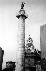
Fig. 3 Trajans column in his forum. |
We are dismayed that Albright said, Since the publication of Robinsons results in 1841 no competent topographer has hesitated for a moment to accept the identification as essentially correct (Kelso 1968:1). If others have checked the distance, they will have discovered that Robinson was inaccurate. But, at any rate, he obviously considered that the 12th milestone should be close to Bethel, wherever Bethel is. The Greek and Latin can mean somewhere near. The same construction also means on or at. |
Fig. 4 Medeba Map. This east-oriented mosaic map of Jerusalem was found in the floor of a church in Medeba, Jordan. (North is to the left.) The Greek letters say, Holy City Jerusalem. (The first letter is missing, however.) The column is on the middle-left, just inside the (Damascus) gate. |
Although The Excavation of Bethel mentions (in chapter ten) references to Bethel in extra-biblical literature, these are not useful in the identification, being only historical references with no definite geographic indicators. The patristic evidences used (in chapter one) are the same ones Robinson used: Eusebius Onomasticon (along with the fourth century Itinerarium Burdigalense). Eusebius and Jerome are almost exactly the same, the former being in Greek, the latter in Latin. Jerome, living later, has corrected and amplified Eusebius in a few places.
Fig. 5. Hadrians Gate, known today as Damascus Gate. The oval marks the top of a column which some think was the 0 milestone. (Cf. Fig. 14.8; Magen 1988: 56). |
Before we use these sources, we should note Robinsons word of caution, This little work is of high importance, although the notices do not always rest on historical facts, and are sometimes colored by legendary tradition. Nor are the two writers always in one accord. But what Robinson says of the fourth century writers is many more times true of nineteenth century explorers, who may have erred even worse in identifying sites lost for hundreds of years. Carl Ritters testimony was, . . . the site of the once so renowned Bethel . . . was completely unknown at the beginning of the present century (Ritter 1866.I: 227). Although Bethel was still well-known in the fourth century, there is no certain historical mention of it (that we know of), for 1400 years after that time. Surely we should have exercised greater caution in accepting Robinsons identification of Bethel. |
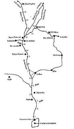
Fig. 6 Map traced from the Survey of Western Palestine sheets. RMS" indicates Roman Milestones which were still in place in 1883. |
In trying to make the Onomasticon fit the situation described, one might argue that travelers turned off at the 12th milestone to go to Bethel (from el-Bireh). But, the route going north completely negates turn offs from the main road. Both el-Bireh and Beitin were on ancient roads between Jerusalem and Nablus. In neither case did one need to turn off, except to go in. In speaking of the route that goes up from Bethel towards Shechem (Judges 21:19), Bethel was obviously beside the road. Nevertheless, our case is based on Roman roads and milestones, and the Roman roads clearly went close to each town with no need for a turn off. |
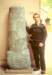
Fig. 7 Author beside a Roman milestone in the EUR museum in Rome. |
However, in the case of Bethel a different preposition is used in the Onomasticon, implying close proximity to the marker, i.e., somewhere near. Eusebius and Jerome mention Bethel several times and always give the same distance from Jerusalem, whether approaching it from the north or from the south. Thus, even though the marker possibly was not in Bethel, it must have been the closest one. Continuing a study of the milestones, Carl Wolf says: Many of the milestones of the first three centuries must have survived into the fourth. For the most part distances seem to be according to mileposts. The slight divergence between Jerome and Eusebius which is often only one mile can be accounted for by the fact that a site is seldom so small as to be only at one milestone and also that in the seventy-five years the roads and starting points normally would change slightly (Wolf 1964: 77-78). Studies in the Bible, and on toponymy, topography, archaeology, geography, etc., are interesting, and can be very helpful. But, in the case of Bethel, only when we deal with distances and milestones do we have some hard evidence. If the proper distance given by Eusebius and Jerome brings one close to el-Bireh, then we have a real problem with the (recent) tradition locating Bethel at Beitin. These church fathers mentioned the distance enough times from both directions that we cannot think they made a mistake, especially when the distances to Ramah and Gibeon prove accurate. Read Part II